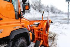
Snow Removal Management
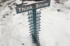
Winter is creeping its way upon us, and brings with it snow in 70% of the United States. Snow depth measuring is a very analog process involving no more than a snow stake in the ground and someone to read it via camera or in person. In theory that’s a solid way to gauge the snow, but in reality, there are environmental barriers to accuracy, mainly wind. A snow stake at the base of the mountain pass could read 10cm at 6 AM, so it’s clear to say it snowed 10cm overnight, but the top of the mountain and all places in between can have significantly more or less snow, making conditions unpredictable for motorists and outdoor enthusiasts.
About GSatTrack
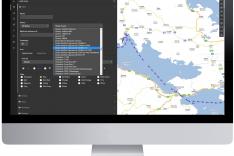
GSatTrack is a web-based, integrated satellite and GSM tracking solution, compatible with modern web browsers and works on a multilingual platform that brings together all the positions of every manufactured product under one location and displays and manages them in a single unified interface. With GSatTrack, asset locations and movements - including position, speed, altitude and heading - are tracked in real-time worldwide via GPS updates.
By using GPS satellites with the latest hardware and technology, any asset on earth, whether it's people, vehicles, containers, or any moving object can now be tracked. Our technology allows the integration of all types of tracking equipment into one easy to use platform. The tracking equipment determines its location by triangulating a position using GPS (Global Positioning System) and then transmits this information via GSM, Satellite, or VHF to a central server for processing. Any operator can view and control any number of real time assets simultaneously.
The Customer Situation
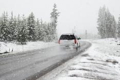
Every year, Over 1,300 people are killed and more than 116,800 people are injured in vehicle crashes due to snowy conditions on roadways. Snow removal, sanding, and salting roads helps these conditions, but there are only so many trucks available to perform the work, so having accurate knowledge of where the heaviest snow has fallen will enable dispatchers deploy the correct equipment to clear the most dangerous areas first.
Example: In 2019, city officials were vowing to improve their snow removal procedures after a storm dumped nearly two feet of snow on the city and made some neighborhoods impossible to access. Streets that would normally be cleared with a standard plow vehicle were unmanagable because of the compaction, heft, and weight of the snow. It meant there was a need for a specific kind of grader to bore through, but without proper data, there was no indication ahead of time that this special equipment was necessary. Plowing crews only found out about the conditions when the normal snow plow arrived and could not clear the street.
The Challenge
Our client needed to know the speed of snow accumulation in near real time, new snow depth by the hour, as well as total depth for the day, month, and season in multiple areas at once. Simply measuring the snow with a stick was not an option, as they needed to monitor several miles of land, some of it in remote areas out of cellular range. What they needed was a digital solution that was affordable, flexible, easy to install, and ideally could serve other purposes after the snow was gone.
The Solution
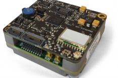
To support a truly modern and accurate snow depth solution for our client, we suggested pairing an Ultrasonic Snow Depth Sensor with the GSatMicro, an intelligent satellite terminal that provides behavior monitoring and management of fixed and mobile assets around the globe. Regardless of your asset type, the GSatMicro Series provides satellite-enabled solutions that can be applied across multiple industries. All terminals in the series provide a global communications channel with optional encryption for transmitting and receiving data on demand whether on land, in the air, or at sea.
To get all of the snow data into one easy-to-use web based user interface, we employed GSatTrack as a perfect solution to gather and display data from multiple sources. All of your operational intelligence data in a single portal: GSatTrack gives managers the power to view the location, behavior, and other telematics data collected by assets in their organization’s technology ecosystem. Assets can be grouped and sorted, interfaces and user permissions customized, and alerts or reports automated to suit your needs.
The Result
Combining the Ultrasonic Snow Depth Sensor with the GSatMicro and GsatTrack portal allowed our client to watch snow levels as they grew in multiple locations at once, allowing them to estimate the hourly accumulation to help them determine their removal plan. The functionality of the GSatMicro doesn’t end there, as the customer was also able to track the plows' locations and behavior on the same user interface as the snow depth. In addition, they could manage the consumption of salt being used on the road, and supply the drivers with valuable emergency communication capabilities out of the treacherous roads.

